Tracks around the World
- Bonneville is located at 4210 foot altitude (Utah)
- El Mirage is located at 2840 foot altitude (California)
- Muroc is located on the Edwards Air Force Base (California)
- Maxton is located at 210 foot altitude (North Carolina)
- Goliad is located at 164 foot altitude (Texas)
- Loring is located at 743 foot altitude (Maine)
- Verneukpan is located at 2887 foot altitude (South Africa)
- Lake Gairdner is located at 397 foot altitude (Austrailia)
Bonneville
View Larger Map |
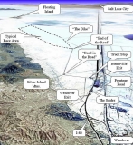
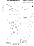
Bonneville Records are set on a long and short course system. Long course system, vehicles over 175 mph, is a 5 mile track (2 miles to get up to speed, then three one mile timed segments). Short Course system, vehicles under 175 mph, is a 3 mile track (2 miles to get up to speed, then one timed mile). All records set at Bonneville are by a qualifing run (over exisiting record), and the next morning making a return run, these two speeds are averaged for the record. All speeds used in the averaging method must be over the SAME relative mile.
- SCTA - BNI - sanctioning organisation home page
- How it works at Bonneville - from the Utah Salt Flats Racing Association
El Mirage
View Larger Map |
SCTA El Mirage records are one way speed records. These are set on a dirt surface at El Mirage Dry Lake in California. The track is 1.3 miles long. Unlike Bonneville, the six-mile-long El Mirage dry-lake bed is composed of compacted clay and silt. During heavy rain seasons, silt is deposited onto the lake-bed, forming a uniformly flat 'hard pan' in the undrained basin.
El Mirage Lake is a dry lake bed in the Mojave Desert of California in the United States. The lake is located about nine miles (14 km) west-northwest of the town of Adelanto and 10 miles (16 km) north of Highway 18 in San Bernardino County.
For 50 years the lakebed has been used by the Southern California Timing Association for timed speed runs. The club also runs the Bonneville Salt Flats speed runs. The dry lake is approximately six miles (10 km) long. El Mirage Lake is part of the El Mirage OHV Recreation Area. It is also known to be an extremely popular filming location for automobile commercials.
- SCTA - BNI - sanctioning organisation home page
- GeoHack - Maps aerial photos and other data for this location
Muroc
View Larger Map |
Muroc Dry Lake (also known as Rogers Dry Lake) at Edwards Air Force Base in California, has been used by the U.S. military since 1933 when a small advance party from March Field in Riverside came to design a bombing range for the Army Air Corps. It was designated a National Historic Landmark in 1985. This is the dry lake that was the original primary landing site for the space shuttles, before they built the runway at Cape Canaveral.
- SCTA - BNI - sanctioning organisation home page
Maxton
View Larger Map |
NATIONAL ONE MILE RECORD HOLDERS
ECTA records are set on an abandoned runway, it consists of a 1 mile concrete track, 30 feet wide. 1.9 miles of total length These records are set using a single speed, one way, sets a class record. Laurinburg/Maxton Airport, North Carolina
- ECTA - sanctioning organisation home page
Goliad
View Larger Map |
Goliad Airport, 200’ wide runway that is 1.5 miles long. MPH calculated by a speed trap located at the last 132 feet of the mile
- Texas Mile - sanctioning organisation home page
Loring
View Larger Map |
Loring Air Force Base is a former United States Air Force base that was under the operational control of the Strategic Air Command (SAC) for most of its existence. In 1992, it was transferred to the newly-established Air Combat Command, and it was finally closed as an active Air Force installation in 1994. Loring is located in Limestone, Aroostook County, Maine.
The first Land Speed event was conducted on July 31st, August 1st, August 2nd, 2009.
Racing from a standing start on a timed 1.5 mile course on the 12,100 foot main runway using the same rules and classes that are used at Maxton.- Loring Timing Association - sanctioning organisation home page
Verneukpan
View Larger Map |
In 1929 the pan was used by Sir Malcolm Campbell, attempting to raise the land speed record in his Napier-Campbell Blue Bird.[2] Unfortunately he failed to break the record. He had vanquished the speed record he had come to South Africa for, but it was 6 weeks too late.
This is also the place where Johan Jacobs died painfully on 27 June 2006. Andy Green also visited the pan during 2008, as Green need to check every possible surface to rank them all for use by Bloodhound SSC.
Support the DLRA
- Promote your business by advertizing in the DLRA Newsletter
- Sponsors Information
