Lake Gairdner - South Australia
Maps of Lake Gairdner
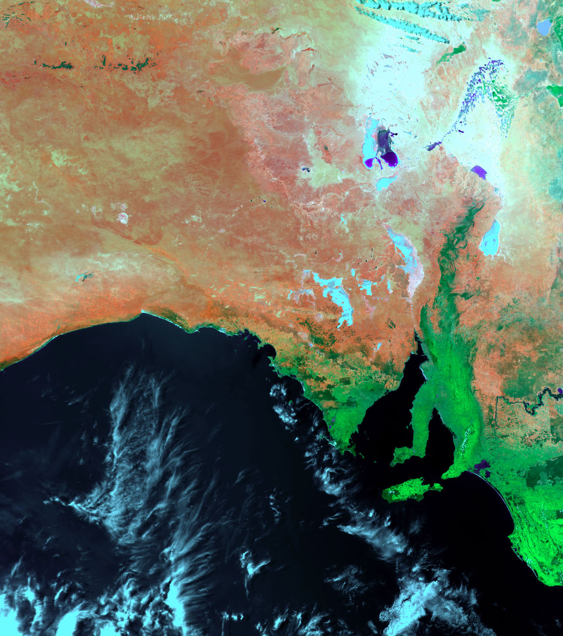
This is an image from the Noaa Satellite. This covers most of South Australia. It is a false colour image to aid interpretation. Lake Gairdner is clearly visable.
Rainfall at Lake Gairdner
Historically Lake Gairdner recieves it's lowest rainfall in. March, followed by April, Feburary, and November
The highest rainfall is typically during June, July August, and September.
In February and March there is historically less than 2 days of rainfall greater than 1mm with the average rainfall for these months being just 10mm.
- Historical Climate Averages (Temp and Rainfall)
- Daily Weather Observations (14 monhts of data)
Lake Gairdner Catchment
The first two maps define the drainage catchments for Australia.
The Gairdner catchment (1) is in the Western Plateau Division (XII).
6 creeks and rivers feed the lake: Garden Well Creek, Gorge Creek, Yeltabinna Creek to name a few.
Usually, those creeks are dry as well, they only flow for a short period after rain. There are no major entry points for rivers and creeks to Lake Gairdner other than from the very North-West tip. Even when it does rain north of the Lake it takes a couple of weeks to get down to where Speed Week is conducted.
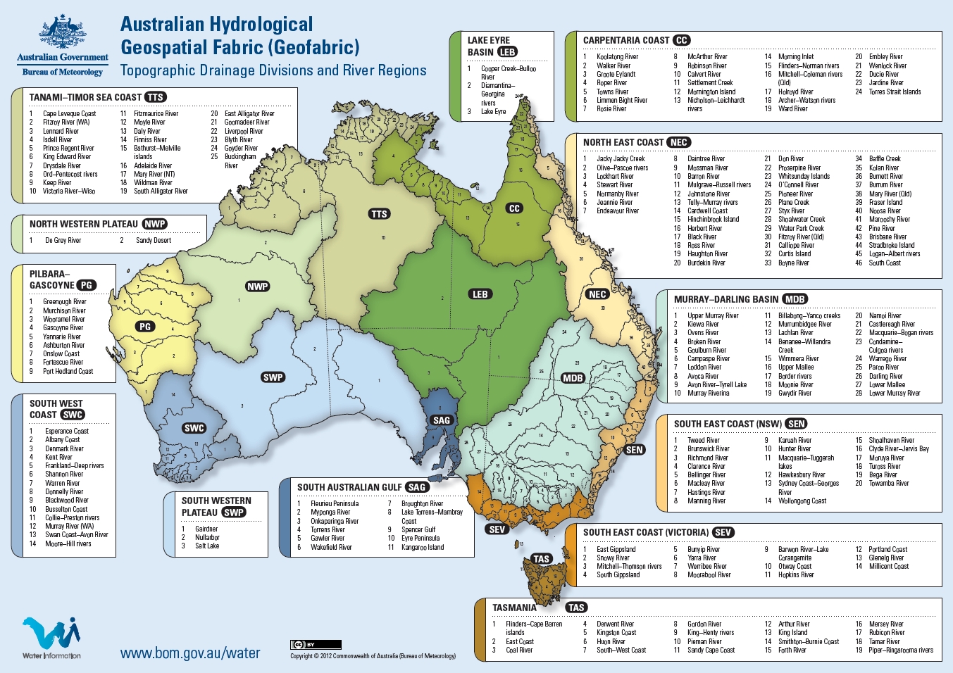 Australian Hydrological Geospatial Fabric
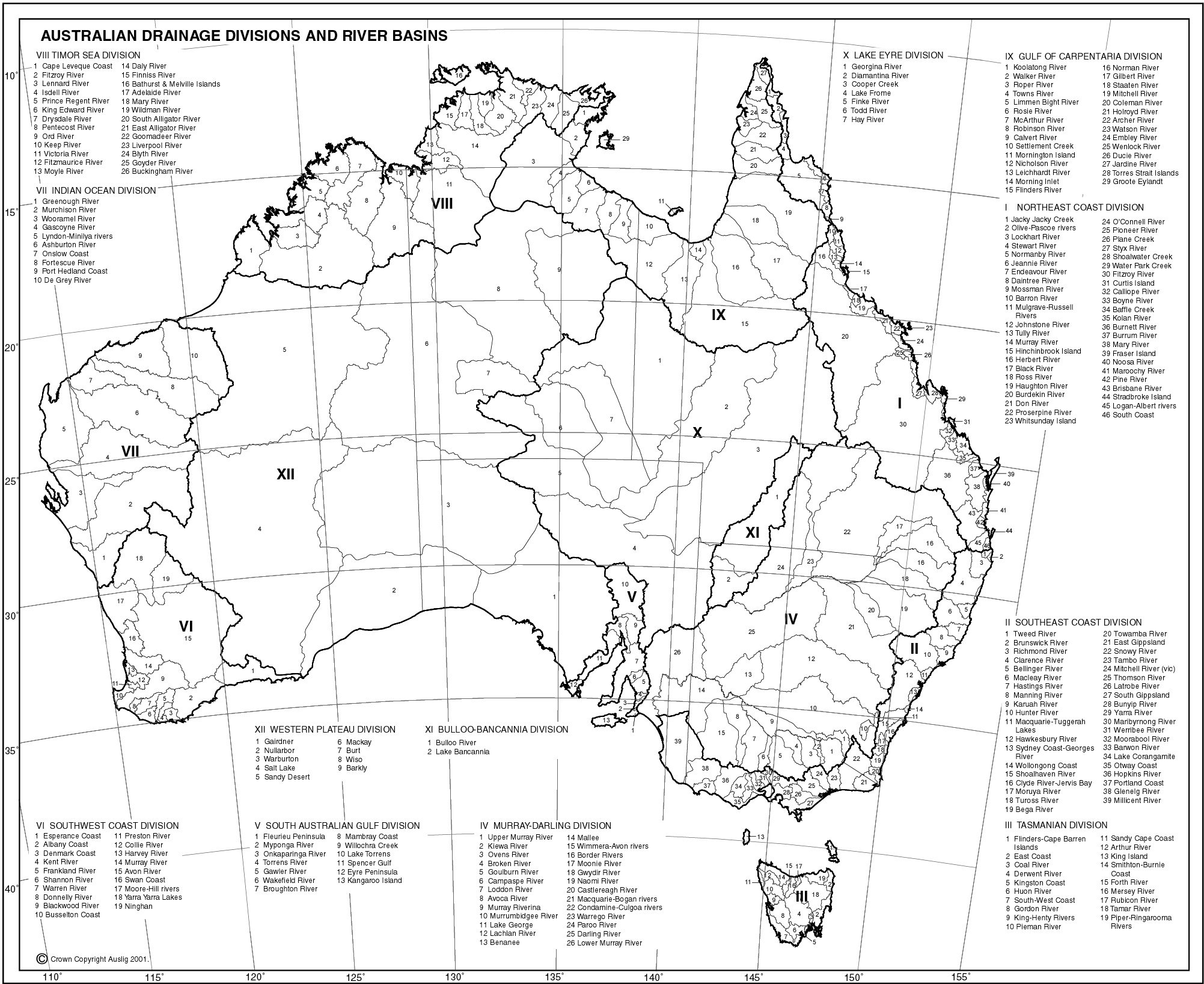 Australian Drainage Divisions and River Basins
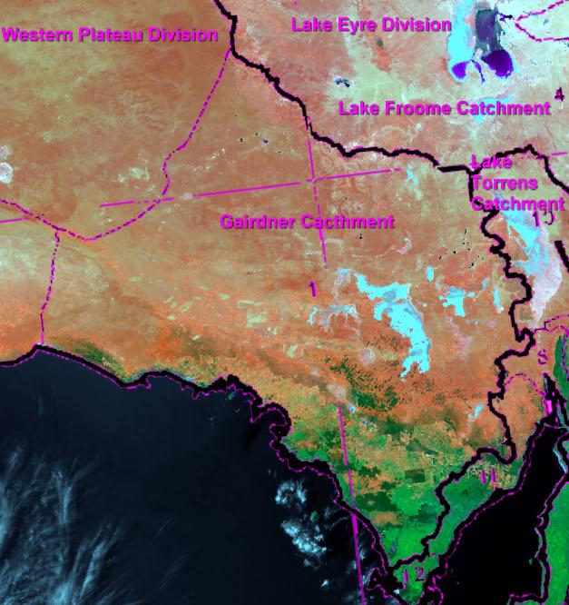 Gairdner Catchment
 Murray Darling Basin - this is why water from the north can never reach Lake Gairdner.
 The Desert Rivers Catchment - directly to the north of Lake Gairdner.
For more detailed information go to the South Australian Flood Warning Centre web page.
Evaporation
Evaporation is dependent on sunshine, temperature, humidity and wind, and is measured as a potential value, assuming an unlimited water supply. Average evaporation rates in the Outback are greater than 3,400 to 4,000 mm per annum. (70 - 100mm per week)
Land Sat images for each year
These images have been lifted from USGS LandsatLook Viewer showing images from around the time of each Speed Week. They can be used as a comparison when trying to favourable conditions at the lake.
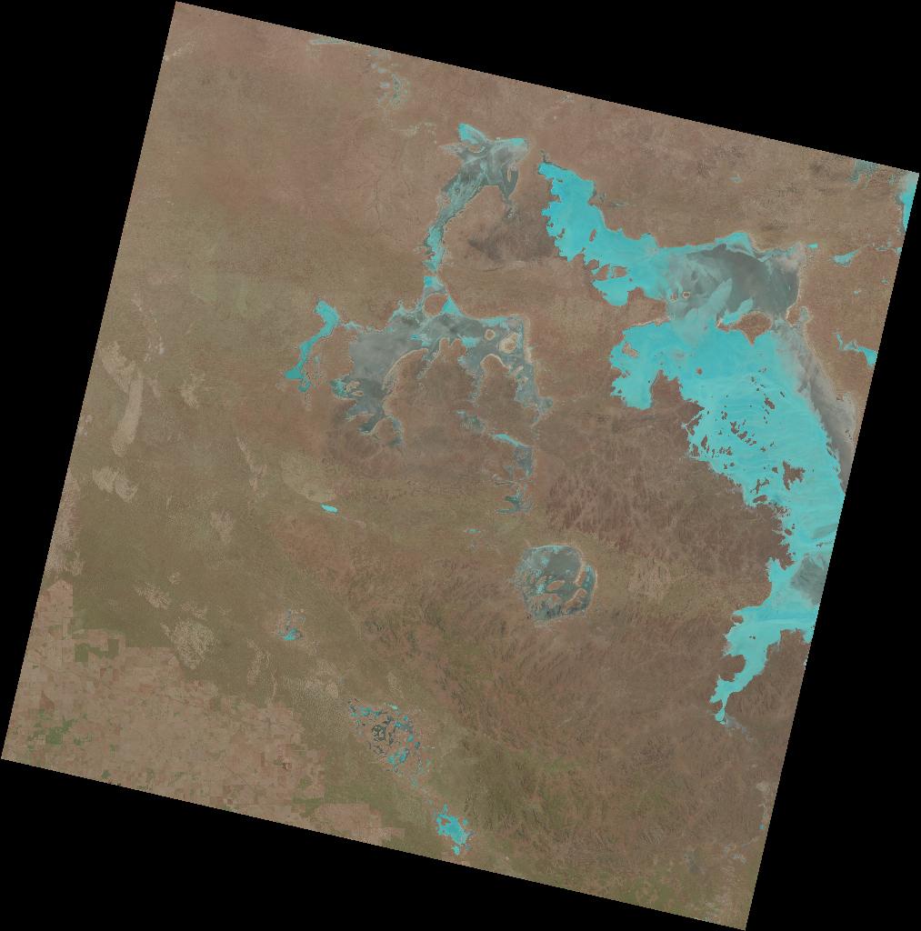 26 February 2015
 19 February 2015
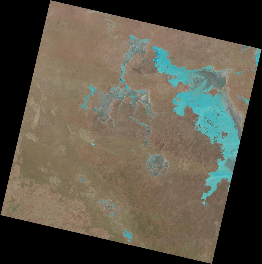 11 February 2015
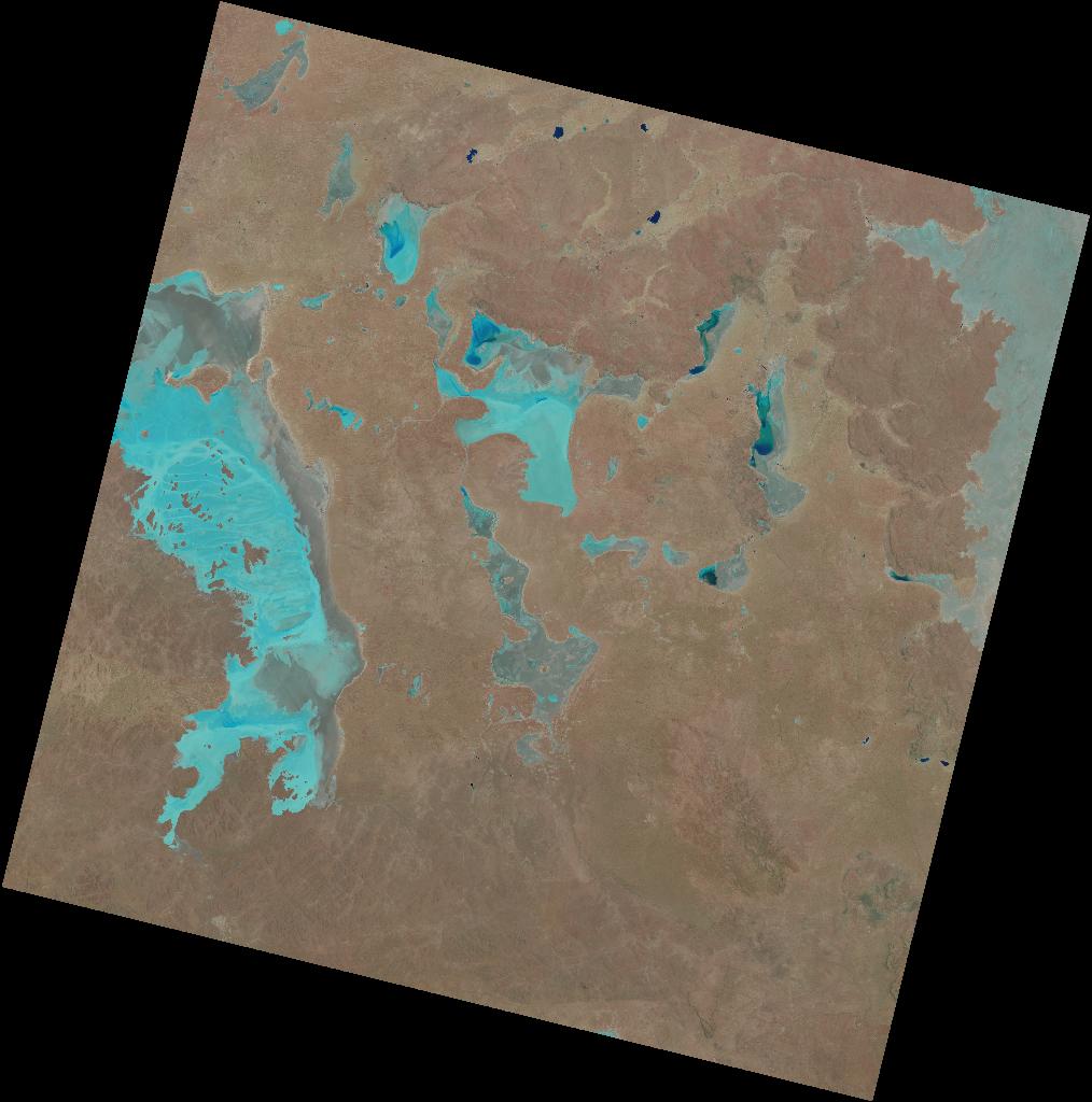 03 February 2015
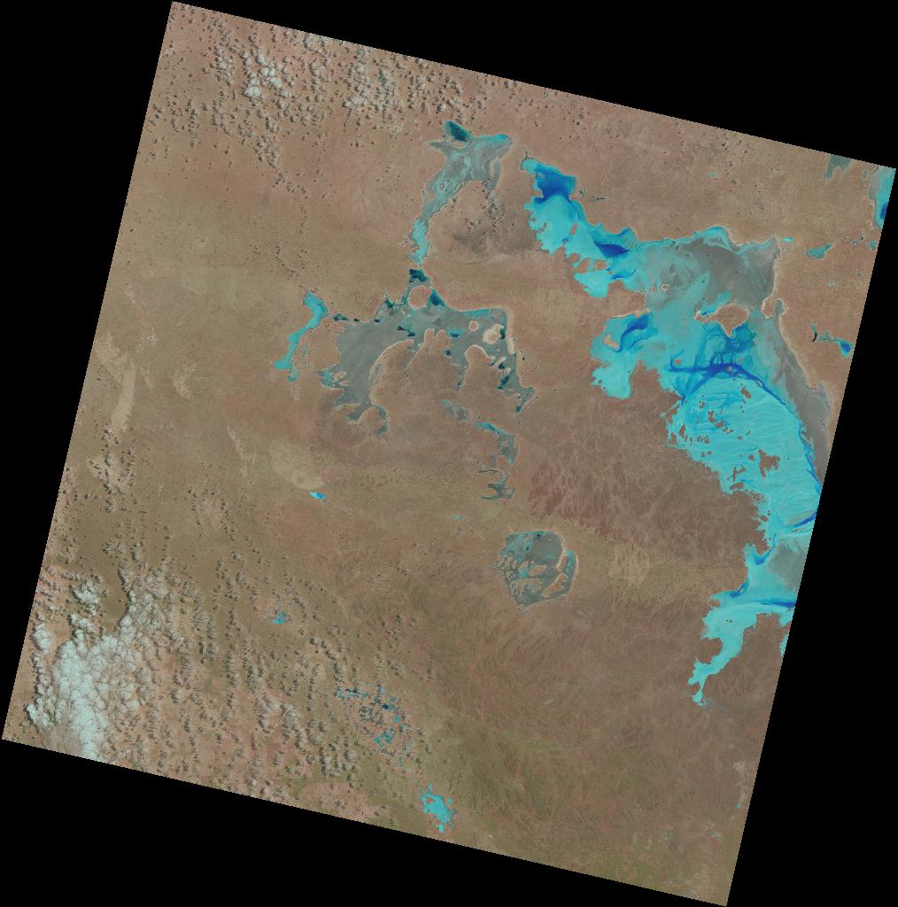 25 January 2015
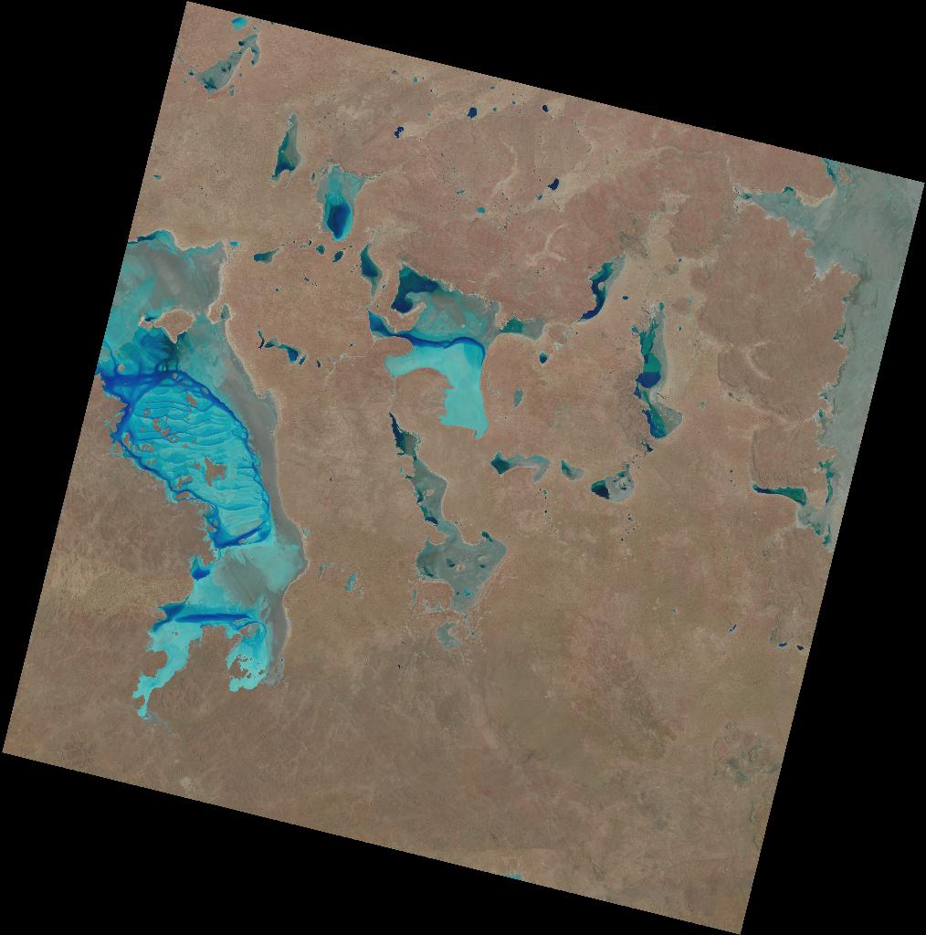 18 January 2015
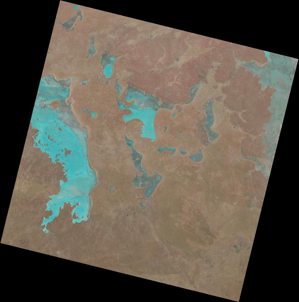 02 January 2015